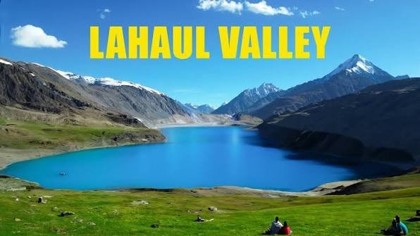
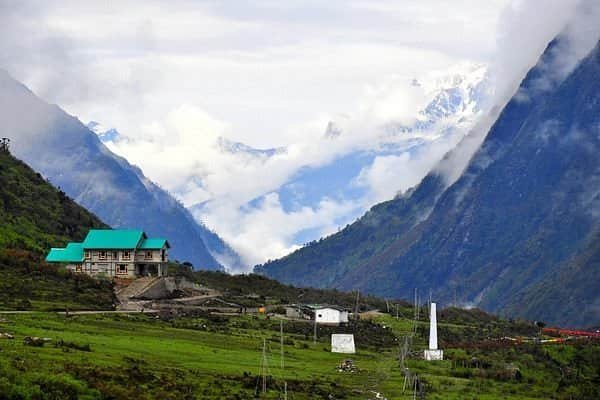
Few valleys in India border quite as much contested and remote geography at once as Tulail — flanked by Gurez to the west, Mushkoh Valley and Drass to the east, the Kashmir Valley to the south, and Gilgit-Baltistan’s Astore district across the Line of Control to the north. Carved out as its own tehsil from the larger Gurez region only in 2014, Tulail has earned the nickname “Little Ladakh” for a landscape that blends stark, wide-open meadows with the Dard-Shina tribal villages that have called this stretch of the Kishanganga River home for generations. It remains one of the least developed corners of Kashmir tourism has reached — no hotels, limited connectivity, and roads that shut down entirely each winter.
Tulail Valley: Quick Facts
| Aspect | Details |
| Location | Bandipora district, Jammu and Kashmir (sub-valley of Gurez) |
| Nickname | “Little Ladakh” |
| Established as Tehsil | 2014 (separated from Gurez) |
| Distance from Dawar | Approx. 30-40 km |
| Distance from Srinagar | Approx. 167-200 km |
| River | Kishanganga River |
| Local Community | Dard-Shina (Dard-Shin) tribe |
| Bordering Regions | Gurez (west), Mushkoh Valley/Drass (east), Kashmir Valley (south), Gilgit-Baltistan/Astore across LoC (north) |
| Best Time to Visit | Late May to early October (peak: June-September) |
| Winter Access | Completely cut off, December to March |
| Known For | Trout fisheries, wooden villages, Khandiyal Top viewpoint |
| Accommodation | No hotels; homestays through local arrangement only |
| Ideal Duration | 1-2 days (as part of a longer Gurez trip) |
How to Reach Tulail Valley
Since Tulail sits deep within the Gurez region, every route to it first passes through Dawar, Gurez’s central town, before continuing further east.
- By Road from Srinagar: The full journey covers roughly 167-200 km, taking around 6-8 hours, typically via Bandipora, past Wular and Manasbal lakes, and over Razdan Pass into Gurez.
- Srinagar to Dawar: The first major leg of the journey, covering approximately 120-150 km, generally taking 4-6 hours depending on road conditions.
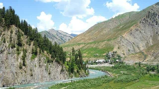
- Dawar to Tulail: The final stretch, roughly 30-40 km, passing through small wooden villages like Badoab, Zarwan, and Sheikhpora, with the road running parallel to the Kishanganga River through thick forest and high cliffs.
- Road Conditions: The route from Bandipora through Razdan Pass to Gurez and onward to Tulail is narrow, rugged, and demanding, so a sturdy vehicle and an experienced local driver are strongly advisable.
- Overnight Stop Required: Given the total distance and road difficulty, most itineraries plan an overnight stay in Dawar before continuing to Tulail rather than attempting the full journey in a single day.
Best Time to Visit Tulail Valley
Tulail’s remote, high-altitude character means its accessible window is considerably narrower than most Kashmir Valley destinations.
- Late May to Early October: The recommended window overall, when Razdan Pass (the connecting route to Gurez and Tulail) stays open and the valley is alive with green meadows and wildflowers.
- June to September: The core summer stretch, with daytime temperatures around 15-25°C, ideal for outdoor activities, trekking, and village exploration.
- October (Autumn): A quieter alternative, with golden hues across the valley, though evenings turn noticeably chilly as winter approaches.
- December to March (Winter): Tulail becomes completely cut off due to heavy snowfall, with temperatures dropping to -10°C to -20°C, ruling out regular travel entirely during this period.
Things to Do in Tulail Valley
Given its remote, sparsely populated character, Tulail’s appeal lies in slow immersion rather than a checklist of formal attractions.
- Fish for Trout: The valley’s rivers are known for excellent freshwater trout fisheries, drawing anglers specifically for this quiet, unhurried activity.
- Explore the Wooden Villages: Tulail’s cluster of 5-10 small settlements, built with traditional wooden architecture, offers a genuine window into Dard-Shina community life, largely unaffected by mass tourism.
- Visit Khandiyal Top: A hillock viewpoint offering a 360-degree panorama over Dawar, the Kishanganga dam’s lake, and surrounding villages — technically closer to Dawar but a natural stop en route into Tulail.
- Walk Along the Kishanganga River: The river’s course through the valley, framed by high cliffs and dense forest, offers some of the most scenic and peaceful walking stretches in the region.
- Photograph the “Little Ladakh” Landscape: The valley’s stark, open meadows set against snow-capped peaks give it a visual character distinct from Kashmir’s typically greener, more forested valleys.
- Engage with Local Dard-Shina Culture: Since the area remains sparsely populated and lightly touristed, genuine conversations with local residents offer far deeper cultural insight here than at more commercialized Kashmir destinations.
A Valley Touching Four Regions
Tulail’s geography is genuinely unusual, and understanding its position helps explain both its remoteness and its cultural character.
- Gurez to the West: Tulail’s parent region and the gateway through which nearly all visitors arrive, sharing much of the same Dard-Shina cultural heritage.
- Mushkoh Valley and Drass to the East: These neighbouring areas, themselves remote and historically significant (Drass being one of the coldest inhabited places in India), reflect the broader isolated, high-altitude character of this stretch of Jammu and Kashmir.
- Kashmir Valley to the South: The more developed, accessible Kashmir heartland that most visitors depart from, standing in sharp contrast to Tulail’s still-undeveloped tourism infrastructure.
- Gilgit-Baltistan Across the LoC to the North: Perhaps the most striking geographic fact about Tulail — its northern edge touches the Line of Control, with Astore district in Pakistan-administered Gilgit-Baltistan lying just beyond, underscoring the valley’s genuinely frontier position.
- What This Means for Travellers: Given this border-adjacent geography, expect a heightened security presence in parts of the valley, along with the kind of quiet, watchful atmosphere characteristic of India’s most sensitive frontier regions.
FAQs
Q1. Is Tulail Valley open to regular tourists, or does it require special permits like some other border valleys?
Tourists can visit Tulail Valley, and unlike some border-adjacent Kashmir destinations, no special permit beyond standard identification is typically required for the core Gurez-Tulail route, though checking current requirements with local authorities before travel is always sensible given the region’s sensitivity.
Q2. Since there are no hotels, how should I plan accommodation for a Tulail Valley visit?
Accommodation runs entirely through basic homestays arranged locally or via a travel guide familiar with the area, so it’s best to arrange this in advance through a Gurez-based operator rather than expecting to find lodging on arrival.
Q3. Is it possible to visit Tulail Valley as a day trip from Dawar, or does it require an overnight stay?
Given the roughly 30-40 km of narrow, winding road each way, a day trip is technically possible but rushed; staying overnight in a local homestay offers a far more genuine experience of the valley’s villages and pace of life.
Q4. How does Tulail Valley’s “Little Ladakh” character differ from the rest of Gurez Valley?
While both share Dard-Shina heritage and remote mountain scenery, Tulail’s landscape leans more toward open, stark meadows reminiscent of Ladakh’s high-altitude terrain, whereas the main Gurez/Dawar area tends to feel slightly greener and more forested — a subtle but noticeable difference for those visiting both in the same trip.