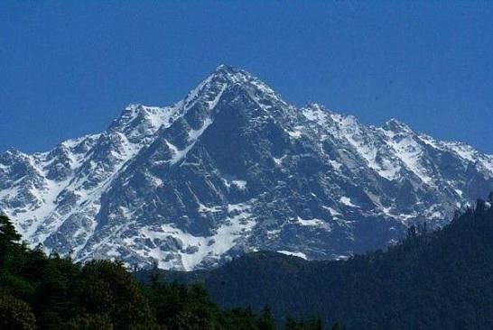
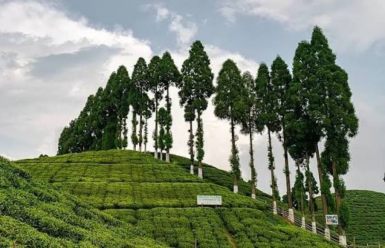
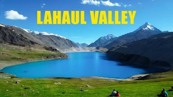
At roughly 300 square kilometres, Bangus Valley is often called the largest meadow in Kashmir — yet unlike Gulmarg or Pahalgam, there isn’t a single hotel here. Split into Bud Bangus (Big Bangus) and Lokut Bangus (Small Bangus), this Trans-Himalayan expanse in Kupwara district’s border zone remains one of Kashmir’s genuinely untouched destinations, reachable only by a mix of jeep roads still under construction and army checkpoints where you’ll show your ID and keep moving. For travellers willing to camp, arrange sturdy transport, and accept a real absence of tourist infrastructure, Bangus offers Kashmir at its most raw and least commercialised.
Bangus Valley: Quick Facts
| Aspect | Details |
| Location | Kupwara district, North Kashmir (Trans-Himalayan range) |
| Altitude | Approx. 10,000 feet (approx. 3,000 metres) |
| Composition | Bud Bangus (Big, approx. 300 sq km) and Lokut Bangus (Small, northeast of main valley) |
| River | Mawri (Mawar) River |
| Distance from Srinagar | Approx. 120-150 km (4-6 hours by road) |
| Distance from Kupwara | Approx. 30-60 km (route-dependent) |
| Permit | Not formally required for Indian nationals; original ID (Aadhaar) mandatory at army checkpoints |
| Nearest Airport | Sheikh ul-Alam International Airport, Srinagar |
| Nearest Railway Station | Baramulla (approx. 64-85 km) |
| Accommodation | None; camping only (own gear or through an operator) |
| Best Time to Visit | May/June to September |
| Avoid | November to April (heavy snow) and late July-August (monsoon mud) |
| Vehicle Recommendation | 4WD strongly advised, especially on the Mawar route |
How to Reach Bangus Valley
Bangus can only be reached by road, and every route funnels through Kupwara or Handwara before the final, rougher stretch into the meadow itself.
- By Air: Sheikh ul-Alam International Airport in Srinagar is the nearest airport, serving as the starting point for the entire journey.
- By Train: Baramulla Railway Station is the closest railhead, roughly 64-85 km away, from where taxis continue toward Kupwara.
- Via Kupwara-Chowkibal Route: The most commonly used approach, running Srinagar to Kupwara (about 2.5-3 hours via Sopore), then onward through Chowkibal or the Kupwara-Karnah road toward Bangus, passing through an army checkpoint along the way.
- Via Handwara Route: A second, often more scenic option, running Srinagar to Handwara (approximately 90 km) before continuing toward Bangus through smaller hills and forest roads.
- Via Mawar/Langate Route: A newer option some travellers use, though the road remains under construction beyond Kupwara on this stretch, making a 4WD vehicle genuinely necessary.
- Road Condition Reality: Transport isn’t readily available given the poor road quality on the final stretch, and parts of the journey may require walking, particularly on the Chowkibal approach where roughly 2 hours of trekking can be involved.
Best Time to Visit Bangus Valley
Given Bangus’s high altitude and its dependence on primitive, unpaved trails, timing here directly affects whether the journey is even feasible.
- May to June: Considered spectacular for lush green meadows and grazing livestock, marking the start of the accessible season as snow clears.
- September: Offers crisp air and the most stable ground conditions for long treks from Chowkibal or Reshwari, making it a favourite for serious trekkers and photographers.
- April to October (Broader Window): Several sources cite this wider range as generally accessible, though actual road and trail conditions vary significantly within it.
- Late July to August: Best avoided even within the broader summer window, since peak monsoon turns the unpaved forest paths into deep mud, impassable for both hikers and horses.
- November to April: Strictly avoid, as the valley gets buried under 10-15 feet of snow, and forest trails become invisible and genuinely treacherous.
Things to Do in Bangus Valley
Given its remote, undeveloped nature, Bangus Valley’s activities centre almost entirely around its landscape rather than any built attractions.
- Camp in the Meadows: The valley’s signature experience, since there’s no formal accommodation, making an overnight stay under open skies the standard way to actually experience Bangus.
- Trek Between Bud Bangus and Lokut Bangus: Exploring both the Big and Small Bangus meadows on foot offers a genuine sense of the valley’s scale and remoteness.
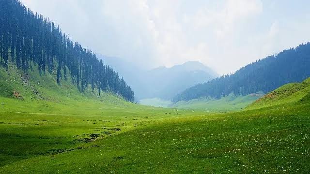
- Photograph the Alpine Meadows: The sweeping, largely untouched grasslands framed by Pir Panjal peaks make this one of Kashmir’s most striking, least-photographed landscapes.
- Wildlife and Bird Spotting: The region reportedly supports around 50 species of wildlife and 10 species of birds, with some local flora noted for medicinal properties.
- Visit Nearby Lolab Valley: Roughly 70 km away, this neighbouring valley is often combined with Bangus for a fuller Kupwara-region itinerary.
- Picnicking Along the Mawri River: The river running through the valley offers a natural, quiet spot to pause during longer treks or camping stays.
Camping and Ground Realities: What to Expect
Since Bangus offers none of the standard tourist infrastructure found elsewhere in Kashmir, a few realities are worth understanding before you go.
- There are no hotels or guesthouses anywhere in the valley, so camping — either with your own gear or through a local operator — is the only way to stay overnight.
- Army checkpoints at Chowkibal or Reshwari require you to show original ID (an Aadhaar card is commonly cited), a routine but mandatory step given the valley’s border proximity.
- Mobile connectivity is minimal to nonexistent once past Kupwara, so plan communication and navigation accordingly before setting out.
- The final stretch into the valley may require walking, particularly via the Chowkibal route, so factor in reasonable fitness and appropriate footwear.
- Given the lack of formal infrastructure, many travellers prefer joining an organized camping trip or hiring a local guide rather than attempting the trip entirely independently.
FAQs
Q1. Do I actually need a permit to visit Bangus Valley, or is it open to all Indian travellers?
Recent accounts indicate no formal permit is required for Indian nationals, though you must carry original identification (an Aadhaar card is commonly cited) and register at army checkpoints along the route, since the valley sits close to the Line of Control.
Q2. Since there’s no accommodation, how should I plan an overnight stay in Bangus Valley?
Camping is the only option, so you’ll either need to carry your own tent and gear or arrange a trip through a local operator who provides camping equipment and logistical support, which many first-time visitors find considerably easier than going fully independent.
Q3. Which route is better for reaching Bangus Valley: via Kupwara-Chowkibal or via Handwara?
The Kupwara-Chowkibal route is more commonly used and passes through the required army checkpoint, while the Handwara route is often considered more scenic; both eventually require navigating rough, partly unpaved roads, so the choice mainly comes down to which starting direction suits your itinerary.
Q4. Is it safe to attempt Bangus Valley without a local guide or organized tour?
Given the poor road conditions, limited connectivity, army checkpoints, and complete absence of tourist infrastructure, most experienced travellers recommend going with a local guide or organized camping tour rather than attempting the trip entirely on your own, especially for first-time visitors to this specific region.